
HEBER, Arizona — Evacuations for two communities have been ordered as fire crews battle the Wyrick Fire, burning in the Apache-Sitgreaves National Forest since June 19.
The fire has burned more than 7,101 acres as of Wednesday.
Here’s a breakdown of everything we know on the fire:
How many acres has it burned?
The Wyrick Fire has burned more than 7,100 acres and is 0% contained as of Wednesday afternoon, fire officials said. The West Chev Fire has burned 288 acres in the same area.
Increasing cloud cover on Wednesday and Thursday, along with higher humidity will give firefighters a short window to make progress building fireline around the Wyrick Fire, fire officials said. Winds will be out of the southwest Wednesday, pushing fire away from Heber-Overgaard, although thunderstorms and gusty winds could quickly change the direction the Wyrick Fire moves.
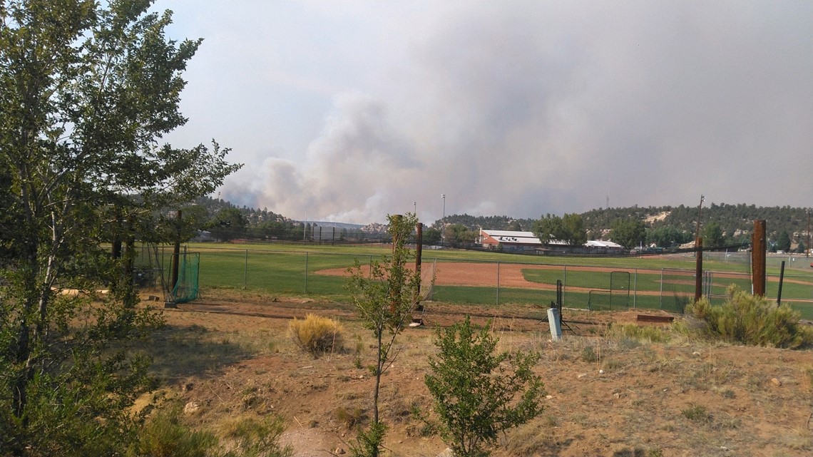
The wildfire was "spreading in all directions" earlier this week, and is burning northwest of Heber, officials said. The fire is threatening 500 kV powerlines that are one mile west of the blaze.
Dry pinyon-juniper and grass are the main fuel source of the fire, and firefighters about continuing high temperatures, outflow winds, and thunderstorms pushing the fire and contributing to the spread.
Navajo County officials declared a state of emergency on June 21. The move frees up funds for additional resources to help control the fire.
Are there any evacuations?
The following communities are under the "GO" order and have been asked to evacuate:
- Despain Ranch
- Antelope Valley
- Heber and Overgaard North of 260 and 277
The following communities are under the "SET" order, meaning residents should prepare their families and homes ahead of time for the possibility of having to evacuate:
- Areas in Heber not identified as Ready or Go status
- Chevelon Ranches and Retreat
- Communities in Overgaard south of Highway 277 and North of Highway 260
The following communities are under the "READY" order, meaning residents should create and maintain defensible space and harden their home against flying embers:
- Overgaard south of Highway 260
- High Country Pines in Heber
- Kendall Ranch / Camp Ponderosa

What roads or highways have been closed?
Authorities have closed the junction of 504/99 to the Salvation Army on 504. The 99 road is also closed.
Highway 277 southbound will be shut down at the Y to Snowflake and Taylor. The northbound lane will remain open for evacuees. Highway 260 is shut down in both directions, in and out of Heber/Overgaard. Evacuees only will be allowed to travel.
A portion of State Route 260 has reopened after being closed. The eastbound lanes are closed between milepost 292 and Heber. The westbound lanes are open to Payson.
Current wildfire closures are as follows:
- SR 377: Heber to Holbrook.
- SR 277: SR 377 to Heber.
- SR 260: Camp Verde to SR 87; eastbound lanes from mileposts 292-Heber.
- SR 87: Payson to Lake Mary Road.
- SR 77: Globe to Winkelman.
- US 191: Mileposts 195-225 (south of Alpine)
All drivers are encouraged to monitor the situations carefully, as these closures are fluid.
Are there any shelters available for residents who may be evacuated?
An evacuation center has been opened at Holbrook High School at 455 N 8th Ave.
12 News on YouTube
Keep up with our wildfire coverage by subscribing to our 12 News YouTube channel.