
PHOENIX — 113 days in a row without measurable rain in Phoenix and counting! Far from a record, this is the desert after all, but a notable streak nonetheless.
Another round of high clouds will filter your Saturday sun with afternoon temperatures warming into the low 70s both Saturday and Sunday.
Because of this stagnant weather pattern, poor air quality could be an issue in the Valley and a high pollution advisory is in effect for Maricopa County Saturday.
Temperatures in the Valley warm into the mid/upper 70s by the middle of next week, making a run at several daily high-temperature records!
Welcome to December in the desert.

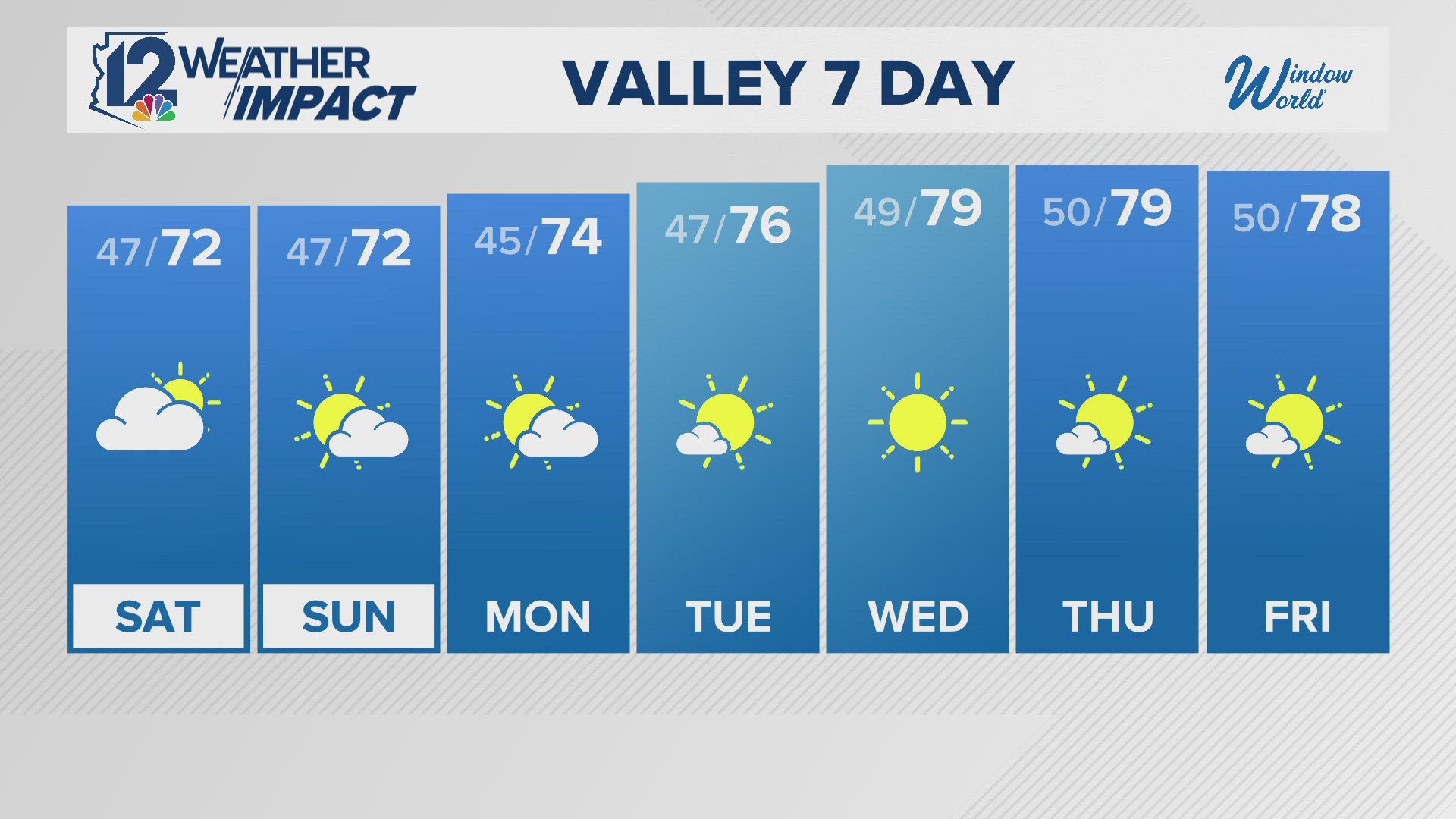
Seven-Day Forecast
SATURDAY: 72/47 Partly cloudy
SUNDAY: 72/47 Mostly sunny
MONDAY: 74/45 Mostly sunny
TUESDAY: 76/47 Sunny
WEDNESDAY: 79/49 Sunny
THURSDAY: 79/50 Sunny
FRIDAY: 78/50 Mainly sunny
Arizona Weather
Arizona has seen its fair share of severe weather throughout the state. Watch a compilation of videos from various thunderstorms, floods, and fires from across the Grand Canyon State on our 12News YouTube channel here.
Be sure to subscribe and see the latest in Arizona weather news and breaking weather emergencies throughout the Valley!
If you see storms, dust, beautiful sunsets, and more and you can safely do so, please share your photos and videos with us in the 12 News app, at pictures@12news.com, or on social media using the hashtag #BeOn12.
Download the 12 News KPNX app for Arizona weather updates:
iPhone: http://12ne.ws/iphone
Android: http://12ne.ws/android