APACHE JUNCTION, Ariz. — The Arizona Department of Transportation is planning to restore limited access to the Apache Trail after flooding damage closed off the roadway in 2019.
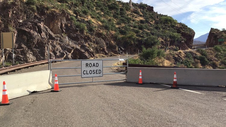
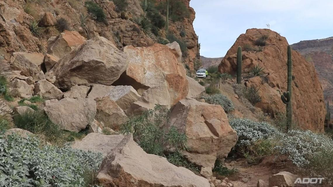
A five-mile stretch of State Route 88 has remained closed for the last five years after runoff from the Woodbury Fire burn scar caused extensive damage.
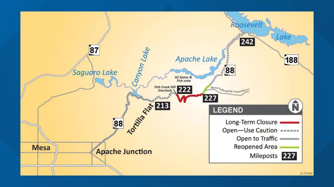
ADOT said crews are beginning to prepare the roadway for a $4 million project this summer that will restore access to high-clearance four-wheel drive vehicles and utility task vehicles. The section of SR-88 that's been closed is located between Fish Creek Hill Overlook and the Reavis Trailhead.
ADOT officials said it would have not made sense to repair the roadway earlier since experts had determined it was going to take several years for the burn scar to revegetate and heal.
The Apache Trail has been used to gain access to the Roosevelt Lake area since the completion of the Roosevelt Dam in 1911. Before SR-88 was closed in 2019, ADOT reported logging over 230 vehicles using SR-88 daily to get to Apache Lake.
ADOT is continuing to seek additional funding for improvements that would make the roadway accessible to other vehicles.


UP TO SPEED
Catch up on the latest news and stories on the 12News YouTube channel. Subscribe today.
What is the Valley?:
“The Valley” is what locals call the Phoenix Metropolitan Area. It is considered the largest metropolitan area in the Southwest.
The Valley is made up of various major cities other than Phoenix, including:
- Mesa
- Chandler
- Scottsdale
- Tempe
- Glendale
- Surprise
- Peoria
- Gilbert
- El Mirage
- Avondale
- Litchfield Park
- Goodyear
- Buckeye
Whether a city is in the “East Valley” or “West Valley” depends on where it is in relation to Phoenix.
The cities of the Valley have a combined population of 4,845,832 people, according to the 2020 United States Census. This makes it the 11th largest metropolitan area in the country right behind the Boston and Atlanta areas.
How big is Maricopa County?
Maricopa County is the United States’ 4th largest county in terms of population with 4,485,414 people, according to the 2020 Census.
The county contains around 63% of Arizona’s population and is 9,224 square miles. That makes the county larger than seven U.S. states (Rhode Island, Delaware, Connecticut, Hawaii, New Jersey, Massachusetts and New Hampshire).
One of the largest park systems in the nation is also located in Maricopa County. The county has an estimated 120,000 acres of open space parks that includes hundreds of miles of trails, nature centers and campgrounds.
The county’s seat is located in Phoenix, which is also the state capital and the census-designated 5th most populous city in the United States.
The county was named after the Maricopa, or Piipaash, Native American Tribe.