
PRESCOTT, Ariz. —
Fire crews are fighting the Crooks Fire, burning 11 miles south of Prescott since April 18.
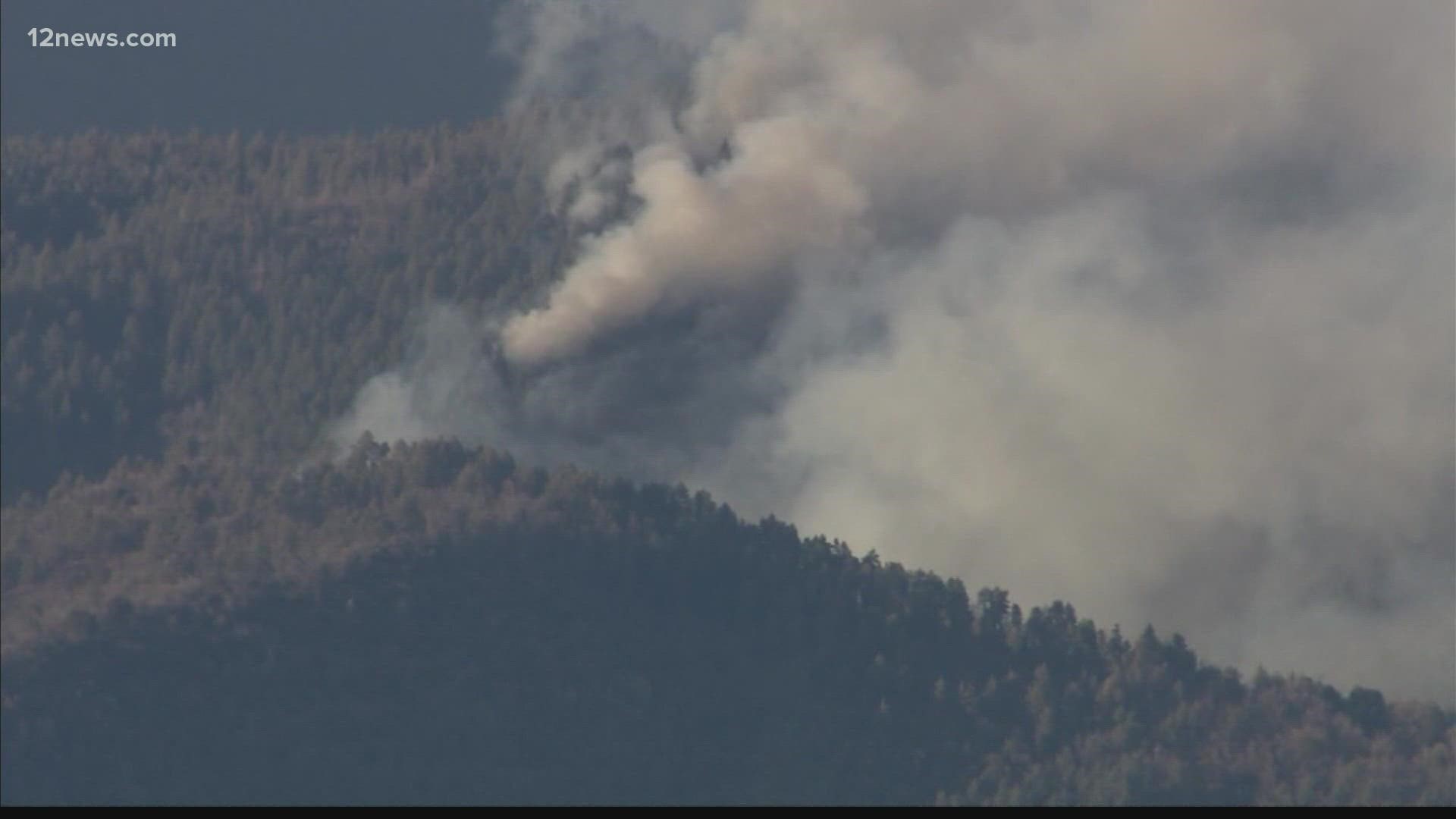
The fire has burned more than 6,454 acres and is 16% contained as of Monday evening.
We are continuing to track the efforts to contain the blaze and will update the public on any new information as soon as it becomes available. Please check back often for the latest information.
Head to 12news.com/wildfires to get the latest information on all the fires burning around Arizona.
RELATED: Incendio forestal Crooks cerca de Prescott crece a 1,600 acres, se ordenan nuevas evacuaciones
Here’s a breakdown of everything we know about the fire:
Latest fire updates
- Nearby communities were instructed to evacuate.
- No structures have been lost at this time
- FEMA's regional administrator granted federal funds on Tuesday to help the state combat the Crooks Fire.
- The estimated containment date is Wednesday, May 4, 2022.
How many acres has it burned?
The Crooks Fire has burned 2,804 acres and is 5% contained as of Friday evening, fire officials said.
"There were significant winds that produced extreme fire behavior and pushed the fire in all directions," fire officials said. "Spotting outside control features."
Are there any evacuations?
The following communities are under the "GO" order and have been asked to evacuate:
- Mtn. Pines Acres
- Camp Kiva
- Mt. Tridal
- Lookout Mountain
- Mt. Tritle
- Kamp Kipa
- Potato Patch
- Breezy Pines
Walker Road residents south of Lynx Lake
The following communities are under the "SET" order and have been asked to prepare for possible evacuation:
- Hopper’s Retreat
- Evan’s Cabin
- Lower Wolf Creek
- Groom Creek and Groom Creek camps
No communities are under a “READY” order.
Go to the Arizona Emergency Information Network website to learn how the READY, SET, GO evacuation system works.
What roads or highways have been closed?
- Goodwin Road - Crown King to Senator Highway
- Walker Rd is blocked at Senator Highway
- Lower Wolf Creek Road blocked at Senator Highway
- Big Bug Mesa blocked at Goodwin Road.
The Prescott National Forest has implemented a forest closure due to the wildfire. You can find a map with the closed areas here.
Are there any shelters available for residents who may be evacuated?
Officials said a shelter has been set up at the Yavapai College Prescott Campus. The address is 1100 E Sheldon St, Prescott, AZ 86301
It was previously at the Findlay Toyota Center in Prescott Valley, but it has moved.
If you would like to contribute, the center is looking for meals and water for evacuees.
Anyone with questions or requiring help can call 1-800-RED-CROSS
What other assistance is available?
Arizona was granted a Fire Management Assistance Grant from FEMA for up to 75 percent of eligible firefighting costs.
FEMA said at the time of the request, the fire threatened 700 homes in and around the communities of Potato Patch, Mountain Pine, Groom Creek and Walker. The fire also threatened 50 businesses, local fire stations, a community center, post office, elementary school, and infrastructure power lines in the area.
Wildfire Go-Kit:
Residents in evacuation areas are urged to have an emergency supplies kit to bring with them when leaving their homes, especially as Arizona residents are beginning to see widespread fire activity throughout the state.
An emergency supply kit should be put together long before a wildfire or another disaster occurs. Make sure to keep it easily accessible so you can take it with you when you have to evacuate.
The National Fire Protection Association (NFPA) recommends that residents near a disaster store emergency supplies in a plastic tub, small suitcase, trash can, backpack, or other containers.
Residents should make sure they have the necessities, such as three gallons of water per person and a three-day supply of ready-to-eat food, the NFPA said. A first-aid kit, prescription medications, contact lenses, and non-prescription drugs should also be taken into account.
Copies of any important family documents, including insurance policies, identification, bank account records, and emergency contact numbers should also be taken and put into a waterproof, portable container in your kit, the NFPA said.
The association lists other items that would help in a disaster, including:
- Sleeping bag or warm blanket for each person
- Battery-powered or hand-cranked radio and an NOAA weather radio to receive up-to-date information
- Dust mask or cotton T-shirt to filter the air
- Matches in a waterproof container
- Complete change of clothing including long pants, long sleeve shirts, and sturdy shoes stored in a waterproof container
- Signal flare
The entire NFPA checklist of supplies can be found here.
Arizona Wildfire Season
Get the latest information on how to stay safe and protect your home during wildfire season in Arizona on our 12 News YouTube playlist here.