

CHANDLER, Ariz. — Hey Chandler, do you know where you live? Maybe you can pick your house out on a map, or find it on Google Earth... But could you find it in a genuine photo taken from space?
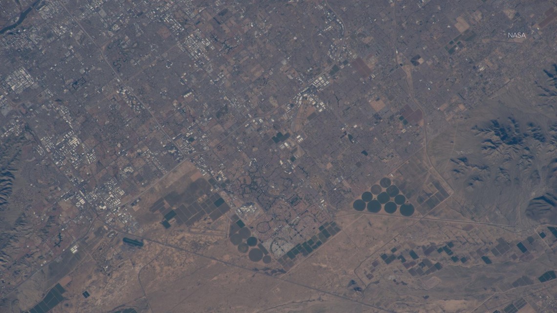
NASA released an aerial of the East Valley city from the International Space Station's pass overhead back in February. The photo is centered on the Sun Lakes area, and clearly shows Interstate 10, State Route 87, and Loop 202 Red Mountain freeway cutting through the area.
Eagle-eyed viewers may be able to pick out the local Ikea near Ahwatukee. You can also pick out the Chandler Municipal Airport and the Wild Horse Pass Motorsports Park.
>> Download the 12News app for the latest local breaking news straight to your phone.

NASA also shared a before and after photo of Chandler's explosive growth from 1985 to 2010.
"Over the last 25 years, Chandler, Arizona has traded its grid of fields for a grid of streets. Founded in 1912 on cotton, grains, alfalfa, and ostrich farms, brown and green irrigated fields still dominate the region southeast of Phoenix in this 1985 natural color image taken by Landsat 5," NASA said on its website.

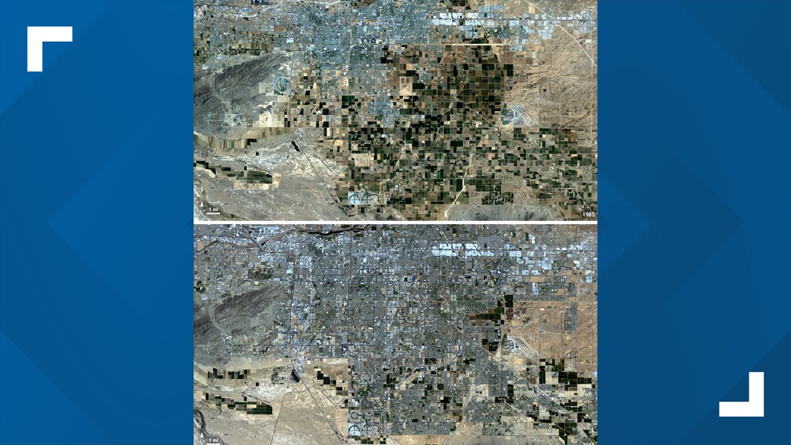
"By 2011, the blue gray city streets in this Landsat 5 image have taken over. Chandler's economy has shifted from agriculture to manufacturing and electronics, and its population boomed from 30,000 people in 1980 to 236,000 in 2010."
WE ❤ ARIZONA
Explore amAZing people, places and things across our state on our 12News YouTube playlist here.